
Lorain County ZIP Code Directory Coverage
The table records the complete 2020 Census ZCTA-to-Lorain County intersection set found in the official Census relationship file and cross-checked with the Census ZCTA-to-place relationships. It is a geographic reference, not a USPS delivery list or a count of every address that accepts a code. A ZCTA is a generalized Census area. USPS ZIP codes are delivery constructs. Therefore, the post-office column directs an exact-address check instead of assigning unverified post-office names.
| ZIP | Areas Covered | Post Office | Notes |
|---|---|---|---|
| 44001 | Amherst, South Amherst, small Lorain overlap | Verify with USPS | City and county boundary mismatch. |
| 44011 | Avon | Verify with USPS | Census-place overlap is Avon. |
| 44012 | Avon Lake | Verify with USPS | Includes Lake Erie water geography. |
| 44028 | Columbia Station area | Verify with USPS | No incorporated-place overlap in the cited relationship. |
| 44035 | Elyria, small Sheffield Village overlap | Verify with USPS | One geography reaches more than one place. |
| 44039 | North Ridgeville | Verify with USPS | North Ridgeville overlap. |
| 44044 | Grafton, Eaton Estates | Verify with USPS | More than one local place. |
| 44049 | Kipton | Verify with USPS | Small village geography. |
| 44050 | LaGrange, Pheasant Run | Verify with USPS | More than one local place. |
| 44052 | Lorain | Verify with USPS | Lorain city. |
| 44053 | Lorain | Verify with USPS | Lorain city. |
| 44054 | Sheffield Village, Sheffield Lake | Verify with USPS | ZIP and place labels differ. |
| 44055 | Lorain | Verify with USPS | Lorain city. |
| 44074 | Oberlin, small Kipton and South Amherst overlaps | Verify with USPS | Wider than one municipal label. |
| 44089 | Vermilion, Beulah Beach | Verify with USPS | Cross-county context needs an exact-address check. |
| 44090 | Wellington, Rochester | Verify with USPS | More than one county community. |
| 44253 | Litchfield area | Verify with USPS | County-edge ZCTA. |
| 44256 | Medina-area ZCTA | Verify with USPS | Small Lorain County intersection. |
| 44275 | Spencer-area ZCTA | Verify with USPS | County-edge overlap. |
| 44280 | Valley City area | Verify with USPS | County-edge overlap. |
| 44851 | New London area | Verify with USPS | County-edge overlap. |
| 44859 | Nova area | Verify with USPS | County-edge overlap. |
| 44880 | Sullivan area | Verify with USPS | County-edge overlap. |
| 44889 | Birmingham and Wakeman area | Verify with USPS | County-edge overlap. |
The Lorain County ZIP code directory is most reliable as a starting geography. It does not establish that every part of a listed ZCTA is inside Lorain County, that each code is a current delivery code for every address, or that a postal label dictates the government office with jurisdiction. Confirm an actual street address before drawing any of those conclusions.
Lorain County ZIP Intersections
Several Lorain County ZIP geographies visibly cross local place or county boundaries. The research identifies 44001, 44035, 44054, 44074, 44089, and 44090 as examples. In practical terms, an Elyria-area code can reach Sheffield Village, a Sheffield code can include more than one named place, and the Vermilion or Wellington edges require extra care. A city-looking address label does not by itself identify the municipality, township, county office, or court service area.
Lake Erie adds another kind of boundary wrinkle. The 44012 ZCTA includes water geography, while a county-edge ZCTA can have only a small Lorain County intersection. The county contains a mix of lakefront cities, suburbs, villages, townships, and rural edges. Use the parcel and GIS context after USPS confirms delivery. That sequence avoids treating a broad code as a municipal boundary.
ZIP and city are different labels. A ZIP can cross a city or county line, and one city can use more than one code. Use the exact address and county parcel record before choosing an office or court.
Lorain County ZIP Address Check
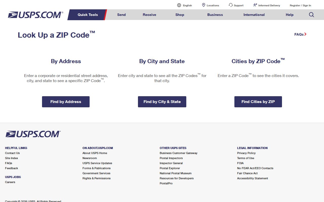
The USPS ZIP Code Lookup is the official check for a specific live deliverable address. It is the right first step when an address has an uncertain city label, a suspected postal-box code, or a boundary location. USPS is the authority for delivery ZIP information. Census ZCTA data is valuable for geographic orientation, but it is not a substitute for an address-by-address delivery answer.
The USPS address lookup form provides the live delivery-verification route used before a Lorain County ZIP code directory search moves into county records.
Keep the standardized delivery result separate from the Auditor's situs record and the Recorder's legal description. Those are different identifiers that may be useful for the same property, but they do not have to match word for word.
Finding Records by Lorain County ZIP
A Lorain County ZIP code directory narrows an area. It does not produce a verified ZIP-wide roster of people. After USPS confirms a complete address, the county property tools can associate that address with a property number, situs location, tax context, and parcel map. A named person may then be checked through the appropriate official record for the question. For a street-wide, address-by-address trail, use the linked Lorain County By Street directory after the ZIP has narrowed the location.
- Enter the full address in the USPS address lookup and retain the live delivery ZIP returned for that address.
- Open the Auditor Location Search and enter the known address components. Preserve the property number and situs result rather than relying on the ZIP alone.
- Use the GIS or Parcel Viewer for parcel context and confirm that the property lies in Lorain County before making a county-specific records request.
- Use Recorder PAX for a recorded-document question, or Ohio Voter Search for a permitted one-person registration check. Each source has different limits.
- Return to the custodian for an older record, an image, a copy, or a result that needs interpretation.
The Recorder is a document-history source and the Auditor is the current parcel entry point. Neither produces a verified complete household list from a ZIP. Ohio Voter Search requires a first name, last name, and county, so it is also not a ZIP-only browse screen.
Lorain County ZIP Auditor Fields
The Lorain County Auditor Location Search has a City, State ZipCode address component. That confirms a ZIP-capable address filter. The inspected public source did not expose the option list or show that the tool returns a ZIP-wide result, so it should not be described as a bulk residents-by-ZIP search. The Auditor's GIS and Tax Map landing page also links to the Parcel Viewer and GIS Portal for parcel context.
| Field | Type | Use and limit |
|---|---|---|
| Tax Year | Selector | Shown on inspected search screens. |
| Street Number | Text | Address component for Location Search. |
| Street | Text | Needed for a productive address search. |
| Pre-Direction, Suffix, Post-Direction | Selectors | Optional address-normalization controls; option lists were not captured. |
| Unit Designator and Unit | Selector and text | Optional unit fields. |
| City, State ZipCode | Selector | ZIP-capable component, not a verified ZIP-wide roster tool. |
| Property Number | Text | County property-number search key. |
| Real Estate and Manufactured Home | Checkboxes | At least one category should be selected. |
The Auditor's Name, Location, Number, Sales, and Custom routes are property research tools. A result can support a parcel or tax-context question. Owner-occupancy is a tax-status attribute, not a complete household roster, and the source inspected does not verify a current mailing-address field.
Lorain County ZIP Record Keys
Postal, parcel, and recorded-document research uses several labels for the same place. Keeping them distinct prevents an address match from becoming an unsupported conclusion. The Auditor uses a location or situs address for property searching. The Recorder carries a legal description through recorded instruments. USPS assigns a delivery ZIP for a live address. Each is useful, but each answers a different question.
- ZIP code
- A USPS delivery construct used to route mail. It is not a municipal or county boundary.
- ZIP+4
- An added delivery segment that refines a ZIP code for a particular address or delivery point.
- PO-box ZIP
- A code associated with post-office-box service. Its delivery status must be verified with USPS.
- Unique ZIP
- A ZIP associated with one organization or delivery arrangement. Do not assume one without USPS confirmation.
- Carrier route
- A mail-delivery grouping. It is not a list of every person living in an area.
- Legal description
- A recorded lot, block, subdivision, or other land description that can remain useful after a street label changes.
Note: A name on a recorded document or parcel record identifies a record connection, not every person who may receive mail at that address.
Lorain County ZIP 44036 Gap
Code 44036 is often associated with Elyria postal-box service, yet it does not appear in the Census ZCTA intersection table. That absence does not prove that the code is inactive, that it is a current postal-box-only code, or that it has no relationship to an Elyria address. The research did not verify its active delivery status address by address. Treat it as a specific verification gap, not as a missing county geography to fill in by assumption.
The same caution applies to potential unique and PO-box ZIPs across the county. The ZCTA intersection list is complete for its Census-geography purpose, but it is not an inventory of all active USPS-only codes. Use USPS before calling any code a delivery answer.
Lorain County ZIP City Limits
A ZIP does not choose the records custodian. Court territory can differ from an intuitive city or county map, and the research notes that Brownhelm Township is served by Vermilion Municipal Court. For a court matter, identify the actual municipality or township and use the court that serves it. For a property matter, rely on the Auditor's parcel record and GIS boundary, not the postal city label alone.
Ohio Voter Search and Ohio DATA voter snapshots have their own county and statutory boundaries. The individual lookup is a named, county-selected confirmation tool. Dated public snapshots carry release rules and redactions. ZIP geography can help organize an address question, but it cannot override a protected record, create a general people list, or prove a current household.
Practical order. Confirm delivery with USPS, confirm parcel county context with the Auditor, then contact the office that holds the record needed for the question.